|
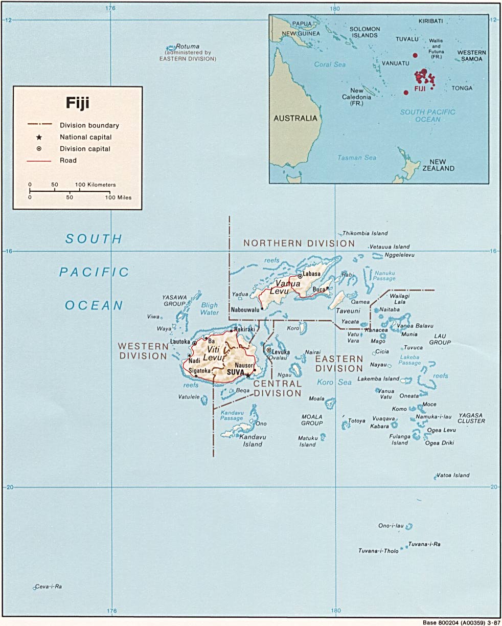
A map dividing Fiji's plate boundaries. As you can see on the map, where the
Sigatoka River Valley is located, the boundary has shifted slightly to the right.
University of Texas Library. Online Maps of Current Interest.2008.
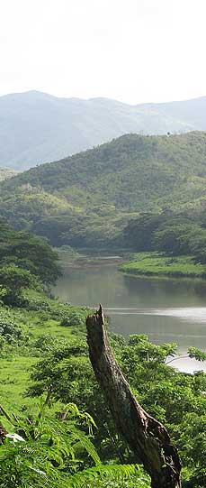
How it was formed...
Around 8 million years ago the Pacific crust was
subducted from the ‘Rim of Fire’ plate boundary, creating Fiji. Due to subduction along the Vityaz arc trench system, there was a blockage because of a thick oceanic crust.
This then reversed subduction on Vitu Levu(Fiji's largest island, which contains the Sigatoka River Valley)[.
Because of this subduction, the Sigatoka
River Valley was formed and this river valley is constantly expanding.
|

